

Sector map of Escia
An interactive image with 4 clickable hotspots. Select a marker to open its card.
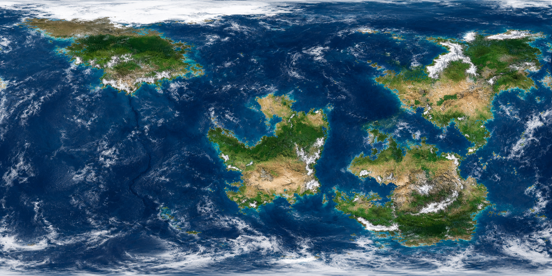
Shared publicly by its creator. Select a marker to explore, or read the project details below.
What's inside this interactive image
Sector 1 - Pancania
Pancania is the first intergrated sector of the United Escia Government, it s a variety of terrain, biomes and weathers, from the southern Yutian Desert that acts as A major energy supply to Escia, to the central and northern Ayevian areas, that act as the the economic core, Pancania is the most populated sector.
Sector 2 - Jamenia
Jamenia is a vast, widely diverse sector, it is the second intergrated sector of the United Escia Government, it contains large mountain ranges, deserts, plains and tropical coasts, known for it's resorts and logistical importance.
Sector 3 -Aeriema
Aeriema is the third intergrated sector of the United Escia Government, it's southern coast is known for being tropical and a large resort, while it's central barrens act as a major energy supply to Escia.
Sector 4 - Bimitria
Bimitria is the fourth intergrated sector of the United Escia Government, it is known for it's northern coldness and it's central forests, known for being a wide logistic hub.
Build an interactive image like this one
Upload any photo, diagram, or floor plan, drop hotspots exactly where you want them, and paste one iframe into your site. Free plan, no code.
Start freeLearn more: interactive image maker · image map generator · guides